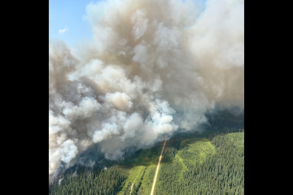
MD OF BIGHORN – An evacuation order declared by the MD of Bighorn due to a wildfire burning in the north Ranchlands area remains in effect, as does an an evacuation alert for the surrounding area.
The fire is now estimated to be 82.9 hectares in size. Earlier today (July 25), it was reported to be 110 hectares, up from 73 hectares on Wednesday (July 24).
“There was an increase in size from yesterday evening and that is in part because there was some increased fire behaviour throughout the day,” said Calgary Forest Area public information officer Anastasia Drummond.
“Having said that, it didn’t grow substantially. It did grow a little bit, but that was also due to a better assessment.”
An evacuation order instated late Tuesday (July 23) affecting residents east of Highway 40 and west of the Ghost Pulic Land Access Point remains in effect. An evacuation alert is also in effect for the surrounding area west of Water Valley (Doc Mills Road – Range Road 62A, Whispering Pine Road – Township Road 294A and Burnt Timber Road).
“Under an evacuation alert, residents should be prepared to evacuate on one hour notice,” states an update from the MD.
The immediate area surrounding the fire is closed.
The wildfire was initially assessed Monday (July 22) and by Tuesday evening it was believed to be about 85 hectares. Further evaluation led wildfire officials to believe it was slightly smaller in scale.
“When we’re first assessing wildfires it’s very much an estimate from what you can see during an emergency situation and that was just a factor of that,” said Drummond.
“As we’re able to get better perimeters and get the fire GPS’d, we will typically see that the size will sometimes increase or decrease, and often that’s just due to more accuracy, rather than any changes in fire size.”
Wildfire attack officers flying overhead Wednesday night helped to get a clearer picture of the scale.
No injuries or loss of life have been reported and there is no immediate threat to public safety or infrastructure at this time.
“The fire did not take any major runs yesterday, although I can see how the jump in size may have caused some concern,” said Drummond.
The fire was caused by lightning and is still listed as out of control. It is located north of Highway 579 and east of Highway 40, approximately 25 kilometres west of Water Valley.
It is mostly burning livestock grazing areas and pasture lands, scattered near ranches, farms and acreages.
Area facilities include Camp Kindle and Fallen Timber South Campground. Camp Kindle evacuated out of precaution and the campground has closed due to road closures in effect.
Closures and access
A state of local emergency has also been called and road closures are in effect for Highway 579, Highway 40, Burnt Timber Road, and Stud Creek Road.
MD of Bighorn communications coordinator Thomas Judek said since implementing the road closures, the MD has received several travel inquiries, mostly from industry, but also area business owners and residents.
As a result, a restricted area entry form has been created for those needing access.
Access to closed roads can only be made from the Burnt Timber Gas Plant or from the eastern roadblock on Highway 579. Those requesting access must fill out the form with a planned entry date and submit to the MD with 24 hours notice. If granted access, they must exit via the same entry.
The form can be found at www.mdbighorn.ca/DocumentCenter/View/4400/Wildfire-Restricted-Area-Entry-Form and must be submitted to [email protected].
Anyone that may require evacuation assistance is asked to call 403-899-9666.
Anyone self-evacuating is also asked by the MD to check in at the Water Valley Community Hall, where an evacuee reception centre has been set up. The centre opens daily at 8 a.m. and tonight will close at 8 p.m.
For assistance moving or to offer help moving livestock, call 403-493-4821. All livestock being moved are being directed to a designated safe site away from the fire.
To sign up for Voyent Alert, which is used by the MD of Bighorn to send out emergency alerts and instruction, visit: https://ca.voyent-alert.com/vras/client.html#!/registration.
Fire response
As of yesterday, Alberta Wildfire had 22 wildland firefighters on site fighting the wildfire, a helicopter bucketing water on the flames and “substantial air tanker support.”
“They were working on the fire for basically most of the afternoon and evening,” Drummond said of the tankers.
“We had skimmer aircraft that were skimming [water] off Ghost Lake, but we also had some aircraft with long-term retardant.”
Wildfire officials also worked throughout the evening to build fire guards using heavy equipment and have continued bucketing water on the site today.
While last night did bring some high winds, it also brought higher relative humidity along with it, and today, some much-needed precipitation. This has helped with fire suppression.
“Leading up to this fire, during the day, we had very low relative humidity that also maintained overnight, and that’s one of the factors that will allow fires to grow significantly, quickly. High heat and low humidity is one of the worst combinations for fire growth,” said Drummond.
Another – much smaller wildfire – was detected by a fire lookout further west, near North Burnt Timber Creek in the MD of Bighorn on Wednesday. It is also believed to have been caused by lightning and is currently being held at less than one hectare.
Fire hazard in the Calgary Forest Area, including the MD of Bighorn, Kananaskis Country, and Îyârhe Nakoda First Nation, is currently rated extreme.
CORRECTION: An earlier version of this article stated an evacuation order due to the fire had been stepped down to an alert, however, both an evacuation order and alert are still in effect. The Outlook regrets and apologizes for this error.
The Local Journalism Initiative is funded by the Government of Canada. The position covers Îyârhe (Stoney) Nakoda First Nation and Kananaskis Country.


